What's new in Visual Nature Studio 3?

Years in the making, VNS 3 is the biggest 3D Nature upgrade ever.
With features that immediately benefit everyone from beginner to advanced users, VNS 3 is already producing great results in the projects of visualization experts around the world.
“VNS3 has made my work so much easier. I deal with large amounts of contour data and building extensive terrain models is a quick process. With the updates to the Database Editor I can see more data in one window and I can modify this data faster. Adding tree cover to my ski resort models is visually easier to create with the new Foliage Page. I am so pleased with VNS3 and all the updates that have been made.” — Chris Willis, Ecosign Mountain Resort Planners Ltd.
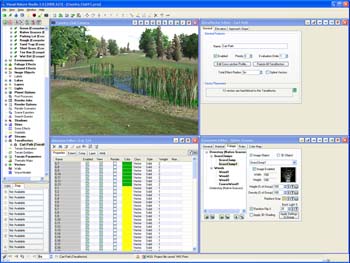
Here are some of the new cutting-edge capabilities VNS 3 offers:
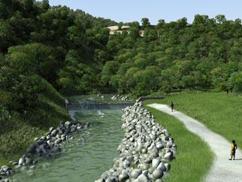
Phong shading
You’ve asked for it practically from day one, and now VNS 3 offers Phong Shading on terrain! Never see another hard-edged triangular facet again, just smooth flowing landscapes. And if you want crinkly bumpy ground, you can apply it just where you want with bump mapping and the new Procedural Terrain Displacement.
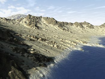
Procedural Terrain Displacement
Instead of the old one-size-fits-all fractal subdivision roughening, VNS 3 now provides the full power of the Texture Engine to your terrain. Apply different patterns in different places, use geo-referenced textures, whatever you like, to make great natural-looking landforms. And they could even be animated! Huge 2500×1240 version can be viewed here.
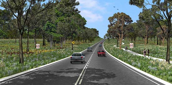
Perfectly Crisp Effect Edges
No longer are vector-attached and bounded effects limited by a crude raster approximation. No more balancing detail against memory consumption when choosing your effect resolution. VNS 3 has an entirely new vector topology engine for processing effects that delivers out of this world results. Every effect has a perfectly clean, sharp edge right where the vector says it should be, all the time. You don’t even need high fractal depth — VNS 3 will split a big terrain polygon right down the middle if an effect edge crosses it, ensuring high definition. Terraffectors too, like roads and sidewalks and cut walls can now have great sharp transitions right where you want them to be, not just where the terrain mesh permits.
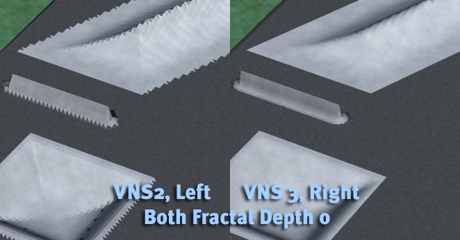
Eliminates High Fractal Depth
Between the Phong Shading and the new Effect Edges, you’ll probably never need high fractal depth again. No need to make tiny facets to break up faceted shading. No need to push the fractal depth to make your effect edges look good. Many projects now look best rendered at fractal depth zero! The only aspect of VNS that still relies on moderate fractal depth is the Rules of Nature — each polygon can still only be one ecosystem, so you use Fractal Depth to control Rules of Nature detail.
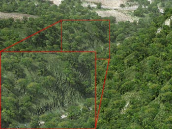
Ecosystem Blending
Another great step forward is VNS 3’s new Ecosystem Blending. No longer do there have to be hard edges between polygons of differing Materials or Ecosystems. VNS 3 can blend the ecosystems and materials across each polygon resulting in a nice smooth transition — more like the real world.
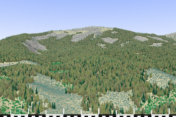
Heading PostProcess
The new Heading PostProcess component gives you a quick and easy way to put compassbearing information right onto your renderings. Display a horizontal degree ruler along the bottom of your image indicating direction and compass bearing numerically so observers can instantly see what direction and horizontal view arc are being shown.
Faster Rendering All Around
All of the improvements above make VNS 3 get the job done quicker. Most projects will render significantly faster in VNS 3 and look better at the same time! VNS 3 has been better optimized to make use of features of modern CPUs as well, making it even faster on every task.
Gridder Densification
Improve the output of the your contour-line gridding with the automatic Densification feature, which makes VNS 3’s gridder see lines as lines, not just a collection of points, improving the tesselation of contour line datasets and making better looking output.
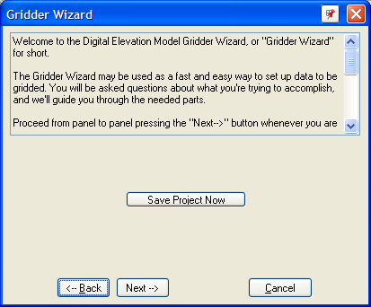
Gridder Wizard
Perplexed by Gridding? Use the new Gridder Wizard to walk through the gridding process step by step, answering each question about your desired result, making gridding an easy process every time.
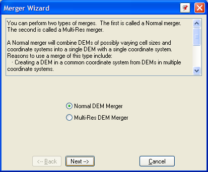
DEM Merger Wizard
DEM Merging, one of the most powerful features of VNS 2, now also has a friendly wizard to help you along. Create simple or multi-resolution merges without having to make and choose Search Queries.
GPS import
A whole new section of the Import Wizard is dedicated to importing data from GPS/GPX or CSV-like files. Choose your file and VNS 3 will (if necessary) offer you a spreadsheet-like importer to specify which fields you want and what to do with each column. Great for integrating field-survey data.
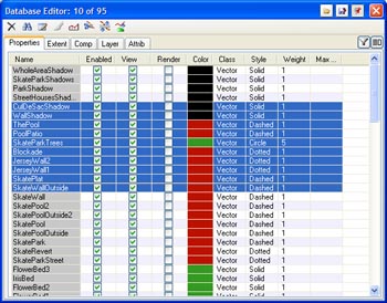
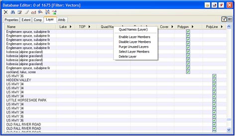
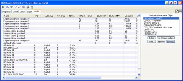
New Database Editor
A complete new design for the Database Editor provides a tabular display of all the properties of every database entity in your project, with columns showing the appearance, extents, enabled states, components, layers and attributes. Everything can be edited right in the table view like a spreadsheet, including multi-selection editing. It’s resizable too, to make use of as much space as you like. Pop-up panels are available for Attributes and Layers to help drill-down into the properties of the selected object. New filtering controls let you display only the DEMs or Vectors or choose a Layer or even a Search Query to use to determine what you see. Tame vast databases instantly!
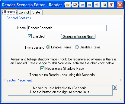
Scenario Improvements
Another powerful VNS 2 feature, Scenarios, has been overhauled and souped up for VNS 3. Simple Scenarios are much easier to create now with an easy on/off control. Advanced animated scenarios are still available, but you don’t have to work with the animation controls if you’re not using them. And a new “negating” control in the Scenario lets you indicate that some bound items should behave the opposite of the others, allowing you to group the “on” and “off” items of a proposal into one Scenario instead of two.
Thematic Maps
Thematic Maps are now much faster and easier to use. No more rasterization limitations here, every thematic map works hand-in hand with the components and vectors it is associated with to get the exact values straight out of your attributes and onto your landscape with a minimum of fuss. Search Queries are no longer needed, making the Thematic Mapping Process as easy as selecting an attribute.
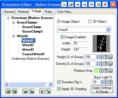
Foliage Editor
Every foliage-utilizing part of VNS 3 now has the same set of controls for managing Ecotypes, Foliage Groups and Foliage Images all from one page. No more Ecotype editor, no more flipping tabs back and forth between Ecotype, Groups and Items. Everything you need all in one place, and only the controls you need visible when you need them.
Walls
Already powerful and flexible, Walls are now much more clever about figuring out complex polygon shapes, able to roof over even extremely complex building shapes and now obeying “island” or “donut” multipart polygon topology.
Smart Lakes
Lakes no longer need to be told what elevation to fill to, they can automatically infer their water level by examining the elevations at the vector containing them. Create all of Minnesota with a single Lake component!
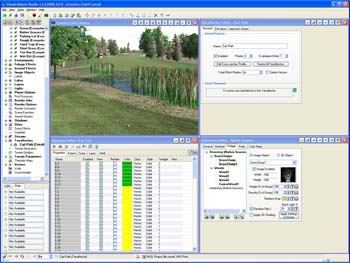
User Interface Improvements
VNS 3 introduces a major user interface overhaul to make everything cleaner, clearer, faster and easier. With a new clean theme, new icon artwork and significant thought into each and every window and button, you’ll get your tasks done quicker than ever before. Here are some of the major highlights of this facelift:
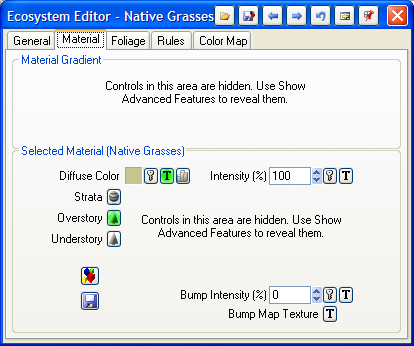
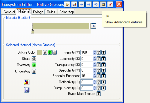
Show Advanced Features
Whether you’re a beginning user or an old hat, sometimes any program just has too many buttons. VNS 3 automatically hides the least-commonly used controls in each window to simplify and speed your operation of the software. When you need access to the more advanced settings, they’re just a button click away, or you can tell VNS 3 to show all the advanced controls all the time if you like to see them.
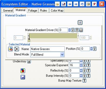
Popup Gradient Editor
With Gradients so commonly used in VNS, we’ve made a new popup gradient editor that gives you all of the sophisticated control you might need when you want them, but folds up into a small graphical display when not in use. This permits much better layout of editors utilizing gradients, often condensing multiple tabs into a single panel and greatly reducing the amount of mouse and keyboard operation needed.
New Icon Imagery
Every graphical button in VNS 3 has been examined and redesigned for maximum clarity, informativeness and appearance. Every Scene at a Glance icon intuitively depicts what it represents and each button is informative and clear.
Toolbar Redesign
VNS 3’s main toolbar has been reworked to only contain the most useful and important controls and make them more prominent and their purpose more obvious. Get to exactly the functions you need without confusion.
View Controls
Each View window now has its navigation and View Manipulation controls available right at hand, in a row of buttons on the titlebar of the View window itself. Never get stuck in Manipulate Camera Mode again — these controls are right where they ought to be and automatically deselect when you’re done with them.
Window Titlebar Controls
All common controls that nearly every window or Editor share are now located as buttons in the window titlebar. Load, Save, Undo, Next, Previous, Dock, Show Advanced Controls, they’re all in one convenient place making more room for clearer and better organized editor windows.
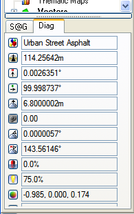
Docked Drilldown and Diagnostics
Two of the most useful tool windows in VNS, the Diagnostics and Drill Down windows, now live docked in the lower portion of the Scene at a Glance. Never have to hunt for the window you want or move it out of the way to work with another tool, they’re present but unobtrusive. The Drill Down Point Info is now even resizable!
Link Widget
All vector-attached components (Ecosystems, Terraffectors, Lakes, etc) now share a common control for displaying and managing their vector linkage. See and manipulate the vectors both hard-linked and soft/query linked to a component in one clean and easy interface.
Overall Refinement
Many small features, too numerous to list, make using VNS 3 easier, faster and more rewarding. These little changes are the result of years of experience operating and teaching our software and seeing how people really use it in the real world.
Scene Express and Forestry Edition
VNS 3 offers the same Scene Express 2 and Forestry Edition features you may already be using. So, you can continue to use these great extensions together with VNS 3’s awesome capabilities.
Who benefits and how?
VNS 3 is immediately intuitive to any 3D Nature user. Everything is where you expect it to be, and is easier to use than ever before. Who can expect to see the biggest improvements?
Foresters and Land Planners
Ecosystem blending and Phong shading get renders done fast and looking great at lower fractal depths. Improved Thematic Mapping makes driving vegetation cover by attributes even easier. The new Foliage Editor will save you time when setting up new ecosystems or customizing existing components. GPS/GPX import speeds field data integration. The new Database Editor makes working with your cover databases much easier and more intuitive. Use Scenarios to easily manage multiple options.
Urban and Architectural
Close-up views look better with phong shading on lawns and smooth surfaces. Streets, curbs and retaining walls have much crisper definition with the new effect edges. Create thousands of complex extruded-building cities using the new smarter Walls. Insert hi-res plans into surrounding terrain with the DEM Merger Wizard. Grid your inset terrain’s contours better and easier with the Gridder Wizard and Densification feature. Get your project done faster and looking better!
Civil and Utility
Visualize everything better, from a cell-tower installation or wind turbine to an entire transmission line corridor. Phong shading and procedural displacement help you make the vast ourdoors look more natural and organic without huge render times. Ecosystem blending and perfect effect edges help you merge new developments like roads and facility sites into the landscape. GPS/GPX import let you collect and use site data easily for tower placements, centerlines and perimeters. Use Scenarios to easily manage multiple proposals.
Artists and Designers
No more polygons to intrude upon your design, just smooth where you want smooth and rough where you want rough. Use procedural textures to reshape the terrain, place landcover exactly where you want it and blend it into the surroundings. Ensure that VNS’s GIS features don’t get in your way unless you need them with the Show Advanced Features controls. Huge 2500×1240 version can be viewed here.
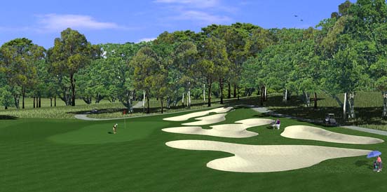
Golf Course Designers
You’re going to love everything about VNS 3, because it’ll make your greens look so smooth, and your roughs look so rough and your carts paths so crisp and you might even imagine it makes your coffee taste better somehow.
You
There’s something great in VNS 3 for everyone. Our Factory Test Pilot group has been working with this tool for over a year, and it has already delivered some amazing results. This is the update that can give your visualizations the winning edge, and get them done under deadline. VNS 3 is so easy to learn and use, you’ll be producing great results instantly upon installing it.
