


Also around 1996 another industry player, Animatek’s World Builder came on the scene, initially with a DOS version, but later for Windows as well. Bryce also appeared on Windows in 1997, making the environment for 3D landscapes very energetic and competitive.

With the new ESRI Shapefile support, GIS users began to combine the visualization power of WCS with the data processing capabilities of traditional GIS tools such as ESRI’s ArcView and ArcInfo to produce results never before seen in the industry. WCS 3 was also first ported to the Apple Power Macintosh.

In 1999, data guru Frank Weed joined the team, and in the spring we held our first training seminar.


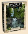 In 2002 3D Nature unveiled WCS 6 with DEM Paint, a completely reworked renderer, true volumetric clouds, an expanded content library of pre-made components, Path/Vector transfer, Joystick Control, Realtime OpenGL foliage preview, better 3D object support, cleaner reflections, High Dynamic Range output, Post Processing and much more. WCS 6 also pioneered the SuperConductor render farm controller for managing large numbers of computers working on one or more projects.
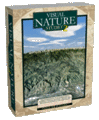 2003 was a very exciting year, with January bringing us VNS 2 with all of WCS 6’s features plus powerful improvements like Image Management, Scenarios, Templates, Thematic Maps, DEM Merging and Splined Terraffectors. Spring heralded the massive Ultimate Earth dataset for creating fast and easy renderings of the entire planet earth (see: “Earth From Space”), as well as a massive Colorado snowstorm that collapsed part of the roof in 3D Nature’s shipping area. Undaunted, we unveiled to the world the innovative Scene Express add-on and NatureView Express realtime Viewer for WCS and VNS, bringing a complete GIS-based authoring system for high-detail, realistic 3D landscapes in interactive real-time. Capping off the year’s achievements, SRTMFill appeared on Christmas Eve to bulk up the stockings of people everywhere using the popular new global SRTM DEM data.
In 2004, we turned to the needs of heavy-duty forestry visualization customers with the VNS Forestry Edition and Forestry Wizard, an add-on for streamlining the visualization of GIS forestry attributes and turning them into accurate vegetation stand visualizations. New add-ons for Scene Express provided support for the OpenFlight (FLT) and rapid prototyping STL and VRML-for-STL file formats.
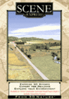 In 2005 we introduced the 3D Nature Foliage Library Components for SketchUp, bringing the vast 3D Nature foliage library to SketchUp users in the form of ready-to-use foliage SketchUp components. All the while, we worked quietly working on the sequel to Scene Express, version 2 of which showed up in January of 2006, bringing export support for FBX, GIS and VNS output along with a more powerful NatureView Express.
With the growing popularity of Virtual Globe tools like Google Earth and NASA’s WorldWind, it was an obvious opportunity to bring the power of WCS/VNS and Scene Express to this fast-growing trend. In April 2006 3D Nature introduced a free Google Earth KML exporter update for Scene Express 2, followed by a WorldWind exporter. In September, the Scene Express was updated again, becoming the first GIS-based tool to support Google Earth 4’s COLLADA textured 3D models and properly-sized crossboard trees.

