Forestry Edition for Visual Nature Studio 2 and 3

In moments I was able to create a scene with accurate vegetation information. Great job! -Kevin Graham, Golder and Associates
3D Nature is proud to offer our forestry customers a new tool that will expedite the creation and population of forestry visualization projects. The Forestry Edition works in conjunction with Visual Nature Studio 2 and later versions to help both new and experienced users get more efficient use out of the powerful forestry features in VNS.
The new Forestry Edition of VNS for Visual Nature Studio 2 and 3 directly connects your forest stand and polygon attributes to your visualization with a few easy clicks of the mouse.

This special edition will walk you through the process of teaching VNS about your forestry data conventions and schemas, after which the program will be equipped to visualize any input data following the same conventions with no further effort!
The Forestry Edition understands point, polygon and raster input data, and is available now for Visual Nature Studio.
This add-on tool will not only allow you to create final images and animations faster but it will also allow you to create Scenarios that can be shared with other VNS users in your professional community. If a co-worker has already entered data that is also applicable to your project it can be saved and used on your work also.
Forest inventory data is expensive to gather. Make the most of it by using the VNS Forestry Edition to examine the data yourself and communicate it in a meaningful way to others.
If your goal is to present an astonishing array of forest stand attributes, planning objectives and modeled scenarios to the public, industry, investors or other stakeholders, then the VNS Forestry Edition is the tool for you.
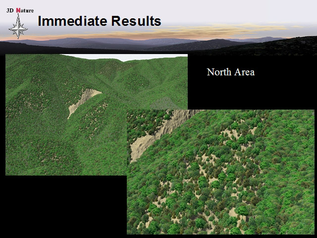
Making the vast amount of information you have gathered understandable to others is a vital task of today’s forestry professional. Visualization – creating a pictorial representation of the data – is the best way to do it. Visualization can also be an indispensable adjunct to other data analysis tools to verify compliance with visual quality objectives.
When you think of the VNS Forestry Edition think of these three key words:
- Simplify
- Expedite
- Articulate
VNS Forestry Edition will:
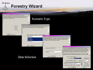
- Simplify the setup of complex forestry simulations. The Forestry Wizard makes it easy for novice users to get accurate, photo-realistic visual results with a minimum of effort and specialized visualization expertise. The wizard knows about many different common forestry database configurations and how to get the most accurate and complete visual output from each of them. You will be guided step by step through the process of identifying to VNS the key elements of your database that determine forest stand characteristics and classifications. You can work with either classified raster imagery or attributed polygon shapes to define the geographic extents of forest types. VNS FE can handle an unlimited number of land cover classes, both vegetated and not.
- Expedite visualization of forestry data. The Forestry Wizard and extended Forestry Edition feature set together help you reach your visualization objectives in record-breaking times. Not only does the Forestry Wizard save you hours of time, it assures accuracy. Repetitive manual setup operations which must be performed in order to visualize complex data structures are sites of frequent human error. Often errors in the setup process go undetected to the later detriment of visual accuracy. The Forestry Wizard handles these repetitive steps automatically. It saves you hours of time and gets the job done right.
- Articulating your forest management activities fully and effectively to a wide audience has never been as easy as it is with the Forestry Wizard. fully and effectively to as wide an audience as possible. Extra features in the Forestry Edition that are not found in basic VNS include the ability to specify vegetation sizes and densities in industry-standard metrics like crown closure, basal area, diameter (DBH) and age as well as the standard height and density metrics found in basic VNS. These values can all be driven directly by polygon attributes in a database.
Order your copy of the Forestry Edition today!
