
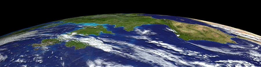
| Ultimate Earth | To paraphrase Douglas Adams, the Earth is Big. Really big. And so is Ultimate Earth. Ultimate Earth is the best quality highest resolution collection of terrain, bathymetry, color imagery and cloud maps we could assemble that covered the entire planet Earth. Ultimate Earth contains nominally 1-km land-mass terrain data, 10-km bathymetry data, 1-km imagery and 5-km plausible cloud map data for the entire globe. The DEM data alone contains over 939 million data points. The imagery comprises one billion pixels.
| ||||
| Optimizations | As such, even programs specializing in large landscapes like WCS and VNS need to take certain measures to effectively cope with such large datasets. Several steps have been taken to make this data compact and manageable.
| ||||
| DEM Compression | In order to fit all of the DEM data onto one DVD-ROM, the ELEV files have been stored compressed and stripped of the Relative Elevation data. This makes them approximately one quarter their normal size. WCS and VNS need Relel data in order to render, and the decompression process would add time to rendering. Therefore, WCS and VNS are designed to recognize these stripped/compressed DEMs, and will automatically decompress them, create the needed Relel data, and resave the ELEV files the first time each is utilized. As is to be expected, this process will take a moderate amount of time initially, and will consume additional disk space on your hard drive where WCS/VNS is installed. Once these ELEV files are expanded, they will no longer incur any additional decompression time in the future. The total size of the ELEV files, once completely decompressed is 5.26Gb. Since DVD-ROM disks can only hold 4.5Gb of data, and additional room for the images is required, this compression and decompression is vitally necessary.
| ||||
| Minimal Projects | To minimize the amount of rendering time and data involved in each project, several partial sub-projects are provided. For the most efficient rendering, select the project that contains the minimum area that covers the required region. For full-globe presentations, use the full project. For continental-scale renders, select one of the provided hemisphere projects: Eastern, Western, Atlantic, Pacific, Northern or Southern. This will reduce the amount of DEMs in the project by half, making Views more detailed and responsive, and making rendering faster. For even smaller regional projects, select one of the quarter spheres such as NorthWestern, SouthWestern, NorthAtlantic, SouthAtlantic, NorthEastern, SouthEastern, NorthPacific, SouthPacific. These quarter-globe projects have one-quarter the total DEM data, resulting in correspondingly smaller projects, more detailed and responsive Views, and faster rendering. For even more limited local regions, start with one of the Quarter projects, and further reduce the number of DEMs by selecting and disabling unnecessary DEMs. VNS users have the option of using the spatial selection capabilities of a Search Query to easily select and activate/deactivate DEMs. Reducing the number of DEMs is always a worthwhile effort. Tech Tip: Note that a complete globe’s worth of stand-in ETOPO5 DEMs is included in each project, set to View but not Render. Therefore, when you load a partial project, you will see the entire globe in Views, but only the partial area of high-resolution will render. Here is a complete list of all of the Projects that UltimateEarth includes:
| ||||
| Drape Image Compression | The imagery has been stored in the compressed TIFF file format, using the deflate/ZIP algorithm. This compression algorithm delivers the highest compression, but may not be readable by all imaging software. In particular, Photoshop versions prior to 7 will not read these images. 3D Nature software prior to WCS 6 and VNS 2 cannot read these images either. VNS 2 and later versions have an Image Management feature that has no trouble dealing with the enormous TIFF images, however, in order to ensure usability for WCS 6 users as well, the imagery has been split into numerous (32) tiles. WCS does not actually load these tiles until they are needed, making it possible for WCS 6 to handle this large amount of imagery. It goes without saying that VNS will also have no trouble.
| ||||
| Multiple Drape Image Resolutions | As an additional optimization, one large low-resolution version of the imagery has been created, and is layered on top of the high-res images. The lo-res version is set to be visible from long distances (when the lo-res data is sufficient, and renders faster with less memory). At closer distances, the lo-res version automatically dissolves to transparent, allowing the hi-res images to show through when needed. WCS and VNS are smart enough to refrain from loading the high-res images until the lo-res images start to dissolve out. In this way, many of the high-res images may never need to be loaded. By the time the camera gets close enough to the Earth to need the hi-res tiles, only a few of them will be in view, reducing the memory requirements. Without these optimizations, WCS 6 would be unable to handle the enormous amount of image data that Ultimate Earth comprises. If needed, the distance at which the dissolve occurs can be adjusted in the project. The adjustment is found as a dynamic parameter (Z Distance) on the opacity channel of the texture in the Material of the Ground Component.
| ||||
Ground Components | Another useful feature is the inclusion of multiple Ground Components. Three Ground components are provided, UEGround, UEGroundClouds and UEGroundShadows. UEGround has only the texturing provided from the imagery drape. If you wish to use real Clouds with UEGround, they are available as a separate component (below). UEGroundClouds has the imagery texturing, and also has the cloudmap layered on top, also as basic texturing. These are not 3D clouds, just the appearance of clouds painted onto the Earth. This is useful for long-distance views, but looks odd when close to the surface. This will render much faster than real clouds. UEGroundShadows has the ground texturing with a darkening effect applied wherever the cloudmap defines clouds are present (using Diffuse Intensity texturing). This simulates the effect of shadowing on the ground below clouds, without the rendering time and memory expense of real shadow maps. This Ground Component is most useful when used with the real Cloud component (below). ETOPO5 Elev Shader is a standard component from WCS and VNS that applies a range of colors based upon elevation, making for an atlas-like shading good for illustrating major terrain features. It does not make use of any of the UltimateEarth imagery.
| ||||
Real Clouds | To create a real cloud layer that hovers over the Earth surface, UltimateEarth provides a Cloud component named UltimateClouds. These clouds are set to render as a single layer, at 15Km above the Earth’s surface, so they will not collide with any terrain. In lower-elevation areas, this will be higher than clouds naturally would be. These clouds will look better than the UEGroundClouds, especially when viewed from low elevations, but will take longer to render. To get the look of shadows falling onto the terrain beneath the clouds, use the UEGroundShadows component, which darkens the ground using the same texture that drives the clouds. This will be faster than using real shadows. Tech tip: This is accomplished using the Diffuse Intensity channel of the Ground material. This technique will work on the illuminated or darkened sides of the Earth. Tech Tip: Due to the impracticality of chopping the cloud image up into multiple tiles, any project using the clouds, real or texture-mapped, will end up loading the entire 8192×4096 pixel cloud image into memory. VNS 2 and later versions have no difficulty with this, but this may consume a large amount of memory on WCS 6 systems. An alternative cloud map image, “ev11643_cloud_combined_4096” is supplied that is only 4096×2048 pixels. No components use this image, but it can be easily substituted into projects using the Image Object Library.
| ||||
Oceans | The Ultimate Earth DEMs, like the ETOPO5 global DEMs supplied with WCS and VNS, have bathymetry. That is, they have the actual sea floor elevations (approximate) encoded into the DEMs. This has numerous advantages, but typically in most projects the sea floor will be covered with an ocean. There are also Ocean components included with Ultimate Earth, UEOcean and UEShinyOcean. The only difference between the two is the specularity channel. In UEShinyOcean, the water material has some specularity to it, which will cause a sunlight glint on the surface. This is normally desirable as real water has this effect. These ocean components also come in variants with shadows or clouds textured onto them. At times however, it may be necessary to use the UEOcean component. For example, the decision of what is ocean and what is not is driven by the elevation in the DEMs. If you use the Ultimate Earth components with lower-quality data (like the ETOPO DEMs, see below) or with data from a different source, the two datasets may not agree on what is water an what is not. Normally this is not a problem as the errors will only occur in small, low-lying areas, and Ultimate Earth will happily paint water color onto lowland areas. However, if the water areas glint and the incorrect water areas on low-lying terrain do not, the difference may become noticeable. In this case, it may be useful to use the non-Shiny version to eliminate the difference. Another alternative would be to make the water be non-Shiny in shallow areas where the discrepancy is likely to occur, but this sort of depth-based shading is just as likely to reveal defects in poor quality bathymetry.
| ||||
| Lighting | In the regional partial projects, the lighting should be automatically set up for your region of interest. When using any whole globe project, the Sun Light will have no idea which part of the globe you want lit, and you will need to set the light position yourself. The Set Position by Time control in the Sun Light Editor is very useful for this purpose, and is the first place you should look if your long-rendered images come out all black.
| ||||
| Haze | Haze and Fog have both been completely disabled in the UltimateEarth projects.
| ||||
| Project Defaults | By default, all of the projects supplied have the UEGroundClouds component enabled, and all other Ground components, Ocean components and the Cloud component disabled. Enable and disable the components required to create the desired effect.
| ||||
| Components with other Projects | The Ultimate Earth Components are installed in various Component Galleries throughout WCS and VNS, allowing easy use of them in other projects with other datasets. Should requirements call for higher (or lower) resolution data, simply create a new project, add the data and add the Ultimate Earth Ground, Ocean and/or Cloud components and render! Generally, if asked, you will not want to scale any component to the current DEM bounds. All components are ready to use, and already in the proper position.
| ||||
| Other Supplied Projects | Also supplied is a version of the ETOPO5 project normally included with WCS and VNS, “UltimateETOPO”, with the Ultimate Earth components already installed into it. This is perfect for moderately high altitude renderings where terrain detail is less important than rendering speed. It uses the same imagery as the full-res Ultimate Earth, so detail is still quite good.
| ||||
| Resolution Limits | Ultimate Earth’s 1Km data is suitable for rendering at video resolution (640×480) from camera positions as low as 579Km above the terrain. At higher resolutions, (2400×3000, 8″x10″ 300dpi), the camera can approach to an elevation of 2897Km before pixels in the hi-res drape image will start to become larger than the pixels in the rendering. In practice, these limits can be pushed quite a bit before the effect actually becomes noticeable. For very low-altitude viewpoints, turning on Pixel Smoothing in the Planar Image Texture Element will eliminate the hard edges between pixels, producing a more blurred look when close to the imagery.
| ||||
| Polar Limits | Most datasets neglect or at least give little attention to polar regions. Ultimate Earth contains data for all parts of the planet, including the poles. However, the Geographic projection used for most global data can exhibit slightly odd behavior at the poles. This will create a ‘pinched’ appearance to the data as the DEMs become might higher-resolution in one direction (East-West) than the other (North-South), due to the converging lines of longitude. This is normally not a problem when overlaying imagery onto the terrain, such as Ultimate Earth provides, but if the DEMs are rendered without the imagery they can look peculiar. Also, dataset interpretation differences mean that a single sample of elevation for the pole itself is not provided, leaving the DEMs to end abruptly 500m from the actual pole, leaving a 1Km hole. Ultimate Earth does suffer from the limitation, though it is usually difficult to notice unless the camera is very close to the either pole.
| ||||
| View Optimizations | WCS and VNS are designed to handle large amounts of DEM data efficiently, and display them in realtime OpenGL Views. Each DEM will be automatically reduced in detail to meet user-specified polygon limits, ensuring reasonably rapid interaction. Nonetheless, loading all of the full-size UltimateEarth DEMs to downsample them for display can be time-consuming itself. Opening a View can take several minutes. Therefore, the use of lower-resolution stand-in DEMs can be a viable option. The UltimateEarth projects have been set up with the lower-resolution ETOPO5 DEMs also in the project, but set to View enabled, Render disabled. The UltimateEarth DEMs are set to Render enabled, View disabled. Therefore, realtime Views will show the smaller, faster, less-detailed ETOPO DEMs, but renderings will feature the full-resolution data. This can be a major interactivity optimization. To save space, the ETOPO5 DEMs are not on the Ultimate Earth DVD-ROM, they were included and installed with WCS or VNS, and the projects should find them automatically. To make working with the ETOPO low-res DEMs easier, they have a Layer of “ETOPO5” added to them in the Database Editor.
| ||||
| WCS 6 Limitations | While Ultimate Earth is designed to work with WCS 6, VNS after version 2, there are certain factors that may impose limitations on WCS 6 users, or require special efforts to avoid limitations. Primarily, these fall into two areas; Memory Management and Datums.
| ||||
| Memory Management | VNS 2 and later versions have a feature known as Image Management which deals efficiently with large amounts of Image data in much the same way as WCS works with large amounts of DEM data – working with it in small pieces, or tiles. This prevents VNS from ever having to load an entire draped image into memory at once, much less several images. Ultimate Earth comprises data originally formed as two massive color images, each about 21,000 pixels wide and high. To alleviate the issue, these images were chopped up into 32 images, each 5400×5400 pixels. This is still a large number of very large (83Mb each) images. These images are set to ‘Keep in Memory Short’ to allow WCS to unload these images as quickly as possible when they are no longer needed. Nonetheless, rendering of areas where numerous full-resolution images are required (polar regions) may tax the memory and virtual memory resources of WCS 6 systems. Another potential snag is the preview thumbnails in the Texture Editor. On WCS 6 systems, if a Texture Element using a large image is selected for editing, that entire image must be loaded into memory in order to generate the tiny preview. This will take some time and consume a moderate amount of memory. We recommend turning off all the Texture Preview thumbnails when editing Ultimate Earth textures, as their benefit in this situation is negligible anyway. VNS systems with Image Management know not to try loading the image to create the preview and will present a Stand-In image that doesn’t need to be loaded from disk.
| ||||
| Global projects and Render Beyond Horizon | All versions of WCS and VNS attempt to automatically determine which DEMs will and will not be visible when working with a global dataset and aggressively minimize the number that must be rendered. In some cases, it may be necessary to disable this functionality by turning on the Render Beyond Horizon checkbox in the Camera being used for rendering. If you experience DEMs not rendering all the way into the distance, or not rendering at all when close to the ground, turn this on. It will result in more DEMs being rendered, and therefore slower renderings.
| ||||
| Ultimate Earth Datums | WCS 6 does not have the ability to mix and match and convert on the fly between data in multiple Datums. (A Datum is a specialized coordinate reference concept that also includes an Ellipsoid – a definition of the exact non-sphericity of the planet.) VNS understands Datums and knows how to mix and match several datums successfully. All of the Ultimate Earth data is in WGS84 Datum, and can be used in WCS 6 along with other data in WGS84. Using data in other Datums (such as ED50 or NAD27) may result in slight misalignments between the Ultimate Earth and the other data. NAD83 is so close to WGS84 that they can be considered the same. In practice, Datum shift misalignments on a planetary scale are unlikely to be noticed in most cases. When used in VNS, Ultimate Earth will know its proper Datum and work as expected with any other data that knows its proper Datum.
| ||||
| Quitting | Because of the large amounts of data involved, safely disposing of a project (when quitting the program or loading a new project) can take quite a bit of time. If you are planning on quitting, you may save time by killing WCS or VNS from the Task Manager once it reports that the Prefs file has been saved. If you plan on loading a new project, first quit the software as above, then start it afresh and load the new project.
| ||||
| System Requirements | Ultimate Earth is a large and complex dataset. We recommend a computer system with 512Mb to 1Gb of memory and a 1.5Ghz processor or faster to be able to efficiently handle the load. Ultimate Earth requires about 4Gb of hard disk space to install, and may require as much as 6Gb once fully decompressed. Approximately 7Gb or more is recommended. |