 Chris Hanson teamed up with Questar and Gary at that time, assisting with user interface development, language conversion, optimization and graphics. The result, announced in August of 1994 was World Construction Set 1 for the Amiga with a host of advanced features (and a name inspired by the popular Electronic Arts’ audio tool of the time “Deluxe Music Construction Set”). WCS was “Multimedia, multidimensional and buzzword-compliant!” and revolutionized the 3D Landscape industry of the time. WCS V1 extended the landcover and vegetation placement techniques of earlier software to include placement of what we termed “Ecosystems”.
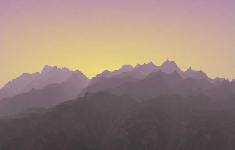
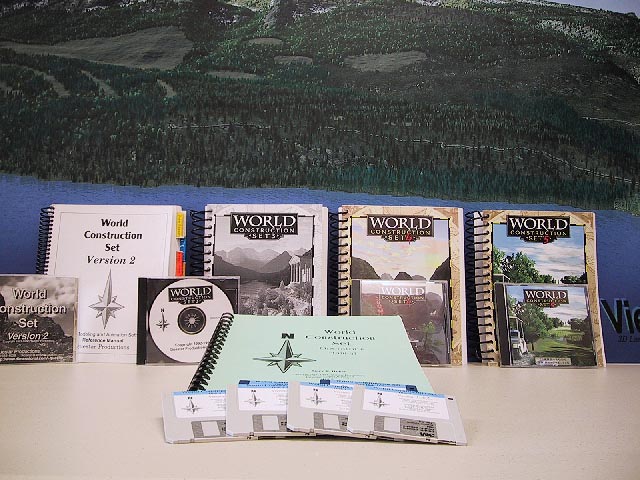
 Work immediately began on a Version 2, as well as support for the new 32-bit Windows NT operating system for the Intel X86 and Hollywood-beloved DEC Alpha computer systems. Notable 3D Nature faces like Jamie Krutz and Mindy Bieging joined the team early on and each contributed their unique skills. Also around this same time, the landscape ray-tracing tool “Bryce” appearing on the Mac with its unique landscape look, along with the initial shareware version of Vue d’Esprit 1.0. WCS V2 for the Amiga arrived in late 1995, followed by a Windows version in Jan of 1996. Version 2 introduced oceans with waves and reflections, DEM building, great-looking clouds, sun and moon, better vegetation, OpenGL support and improvements all around.
Also around 1996 another industry player, Animatek’s World Builder came on the scene, initially with a DOS version, but later for Windows as well. Bryce also appeared on Windows in 1997, making the environment for 3D landscapes very energetic and competitive.
 WCS 3 arrived in January of 1998, with a bang, introducing the groundbreaking Terraffectors (for roads, stream beds, building sites and raising and lowering regions), lakes (constrained areas of water), streams (water following a non-flat path), shadows, and vector-bounded effects (vegetation placed within a bounded outline), offering an enormous degree of landscape customization, alteration and control, as well as a great-looking package design. Once again, WCS shook the industry and caught its attention.
With the new ESRI Shapefile support, GIS users began to combine the visualization power of WCS with the data processing capabilities of traditional GIS tools such as ESRI’s ArcView and ArcInfo to produce results never before seen in the industry. WCS 3 was also first ported to the Apple Power Macintosh.
 WCS 4 followed shortly in August of 1998, bringing full support for internal rendering and animation of 3D objects like buildings, bridges and structures, a simplified and cleaner user interface, more flexible Terraffectors, animated image sequences as foliage, and improved Map and Camera Views. January 1999 brought the (free) 4.5 update adding comprehensive support for texturing on 3D Objects.
In 1999, data guru Frank Weed joined the team, and in the spring we held our first training seminar.
 In the summer, Questar Productions finally chose a new company name, 3D Nature, to better reflect what the company actually did (having given up video production long ago).
Spring of 2000 heralded the long-anticipated release of WCS 5 with a completely redesigned user interface and comprehensive improvements throughout the program. Numerous historical limitations were removed, allowing unlimited numbers of items (Ecosystems, Cameras, Celestial Objects, ColorMaps, etc) that had previously had fixed limits. The UI was simplified and expanded. Map View and Camera View were combined into Views, and any number of Views could be open at once in the new UI Matrix. Scene at a Glance gave a concise-through-detailed view into the entire project, as well as an easy location to manage data. Components and the Component Gallery provided a great way to make self-contained and reusable scene building-blocks, a backbone that has carried into all future versions.
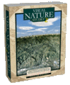
 After years of hard work, Autumn of 2001 delivered 3D Nature’s first fully GIS-aware and capable landscape visualization tool, Visual Nature Studio 1 which again revolutionized the industry. VNS integrated a new high-speed terrain gridder, support for unlimited projections, datums and spheroids with dynamic reprojection and import of georeferenced (GeoTIFF) images along with a greatly-expanded list of supported file formats. Search Queries allowed for the instantaneous binding of Components (like Roads) to a large number of vector paths based on user-specified criteria. Extruded Walls made it easy to build entire cities of buildings rapidly from outlines. Dynamic ReImport helped VNS keep up with external data that might change frequently. VNS immediately made the task of creating visualizations from diverse GIS data significantly faster and easier. A specialized version of VNS, known as the EDSS (Ecosystem Decision Support System) project was created under contract to be an automated visualization back-end for a sophisticated growth modeling tool for a US Army base.
 In 2002 3D Nature unveiled WCS 6 with DEM Paint, a completely reworked renderer, true volumetric clouds, an expanded content library of pre-made components, Path/Vector transfer, Joystick Control, Realtime OpenGL foliage preview, better 3D object support, cleaner reflections, High Dynamic Range output, Post Processing and much more. WCS 6 also pioneered the SuperConductor render farm controller for managing large numbers of computers working on one or more projects.
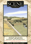
 2003 was a very exciting year, with January bringing us VNS 2 with all of WCS 6’s features plus powerful improvements like Image Management, Scenarios, Templates, Thematic Maps, DEM Merging and Splined Terraffectors. Spring heralded the massive Ultimate Earth dataset for creating fast and easy renderings of the entire planet earth (see: “Earth From Space”), as well as a massive Colorado snowstorm that collapsed part of the roof in 3D Nature’s shipping area. Undaunted, we unveiled to the world the innovative Scene Express add-on and NatureView Express realtime Viewer for WCS and VNS, bringing a complete GIS-based authoring system for high-detail, realistic 3D landscapes in interactive real-time. Capping off the year’s achievements, SRTMFill appeared on Christmas Eve to bulk up the stockings of people everywhere using the popular new global SRTM DEM data.
In 2004, we turned to the needs of heavy-duty forestry visualization customers with the VNS Forestry Edition and Forestry Wizard, an add-on for streamlining the visualization of GIS forestry attributes and turning them into accurate vegetation stand visualizations. New add-ons for Scene Express provided support for the OpenFlight (FLT) and rapid prototyping STL and VRML-for-STL file formats.
 In 2005 we introduced the 3D Nature Foliage Library Components for SketchUp, bringing the vast 3D Nature foliage library to SketchUp users in the form of ready-to-use foliage SketchUp components. All the while, we worked quietly working on the sequel to Scene Express, version 2 of which showed up in January of 2006, bringing export support for FBX, GIS and VNS output along with a more powerful NatureView Express.
With the growing popularity of Virtual Globe tools like Google Earth and NASA’s WorldWind, it was an obvious opportunity to bring the power of WCS/VNS and Scene Express to this fast-growing trend. In April 2006 3D Nature introduced a free Google Earth KML exporter update for Scene Express 2, followed by a WorldWind exporter. In September, the Scene Express was updated again, becoming the first GIS-based tool to support Google Earth 4’s COLLADA textured 3D models and properly-sized crossboard trees.
 2007 and 2008 were quiet on the new release front but there was significant work going on “under the hood” of VNS. In the summer of 2008 we were able to announce Visual Nature Studio version 3. With this complete rewrite of the rendering system amazing new capabilities and realism were added with the advantage or faster rendering times! A new interface and workflow improvements topped off the industry leading new features.